Below you will find more than 20 maps of Dogtown from 1903. I've had to chop them up some in order to make them more visible. However, before I post the individual maps, I have the key to the maps, a map of all Dogtown in 1903 with each colored space being one map and the number of that map is within that color. See below.
Dan McGuire has provided links to every map in this series. The value of these original maps is that they may be blown up fully to where every address and tiny detail becomes clear.
Click here to go to that page where you can just click map by map to the originals
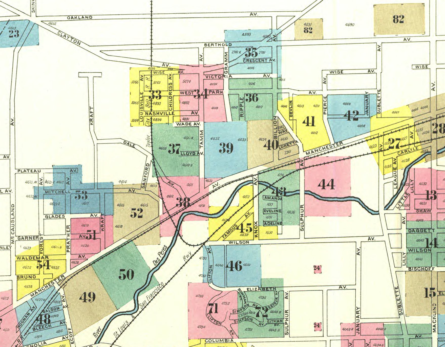
Note that The Taylor City Belt Line is best seen on this map of the maps. The Pacific Railroad and Frisco SHARED the track for the Taylor City RR. That track had to begin
east of Kingshighway, and slow rise up on a tressle so it could cross the River des Peres, and turn slowly north toward Forest Park.
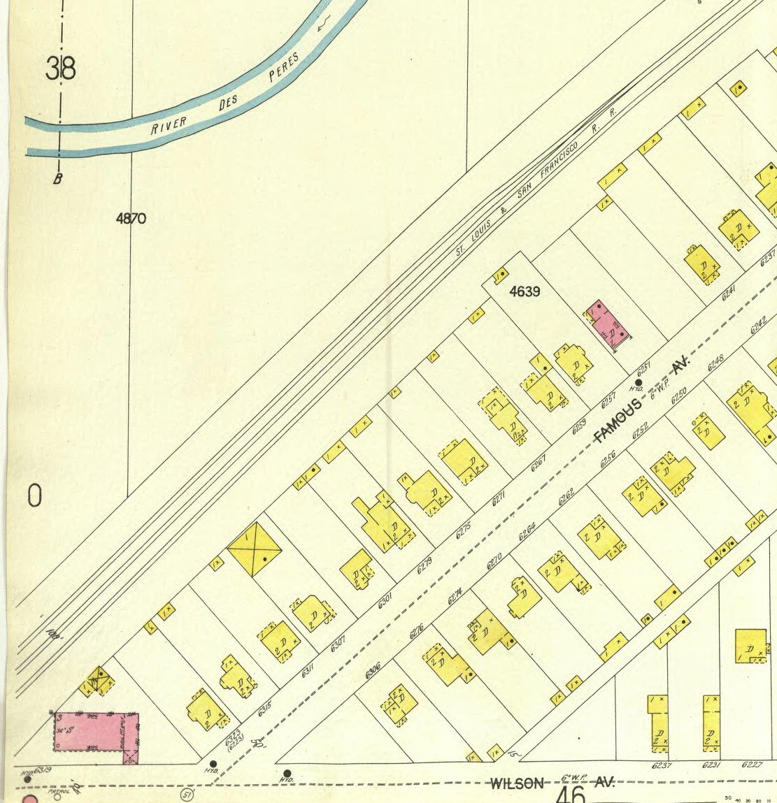
Thus note that right at map #46, top left corner, the track begins to turn north, up onto the tressle and over the river. It continues to run north through maps 38, 37, and 33 to very close to Clayton Ave.
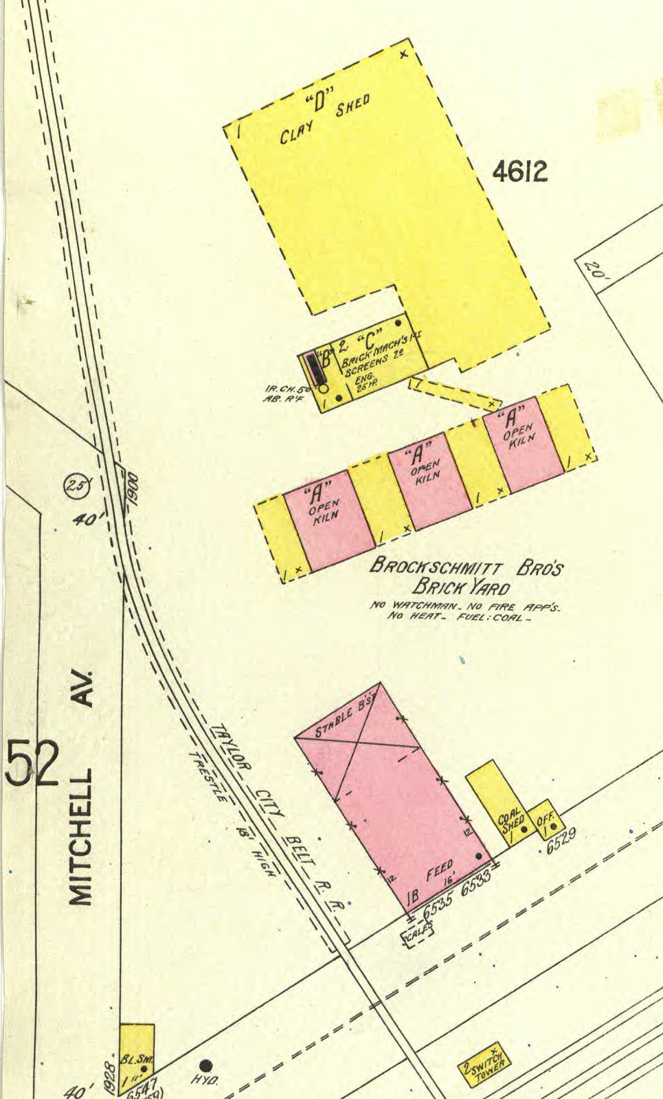
Note there is a lot of white space on the map. These are areas where there were NO BUILDINGS AT ALL. Vacant land. Lots of it in our area in January 1903, but before the Fair began a year later, much more had been built.
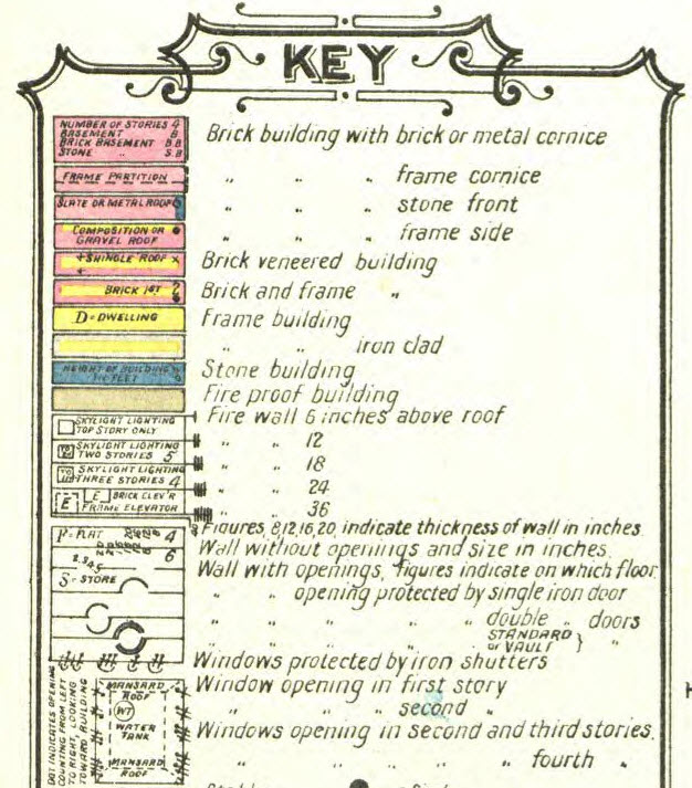
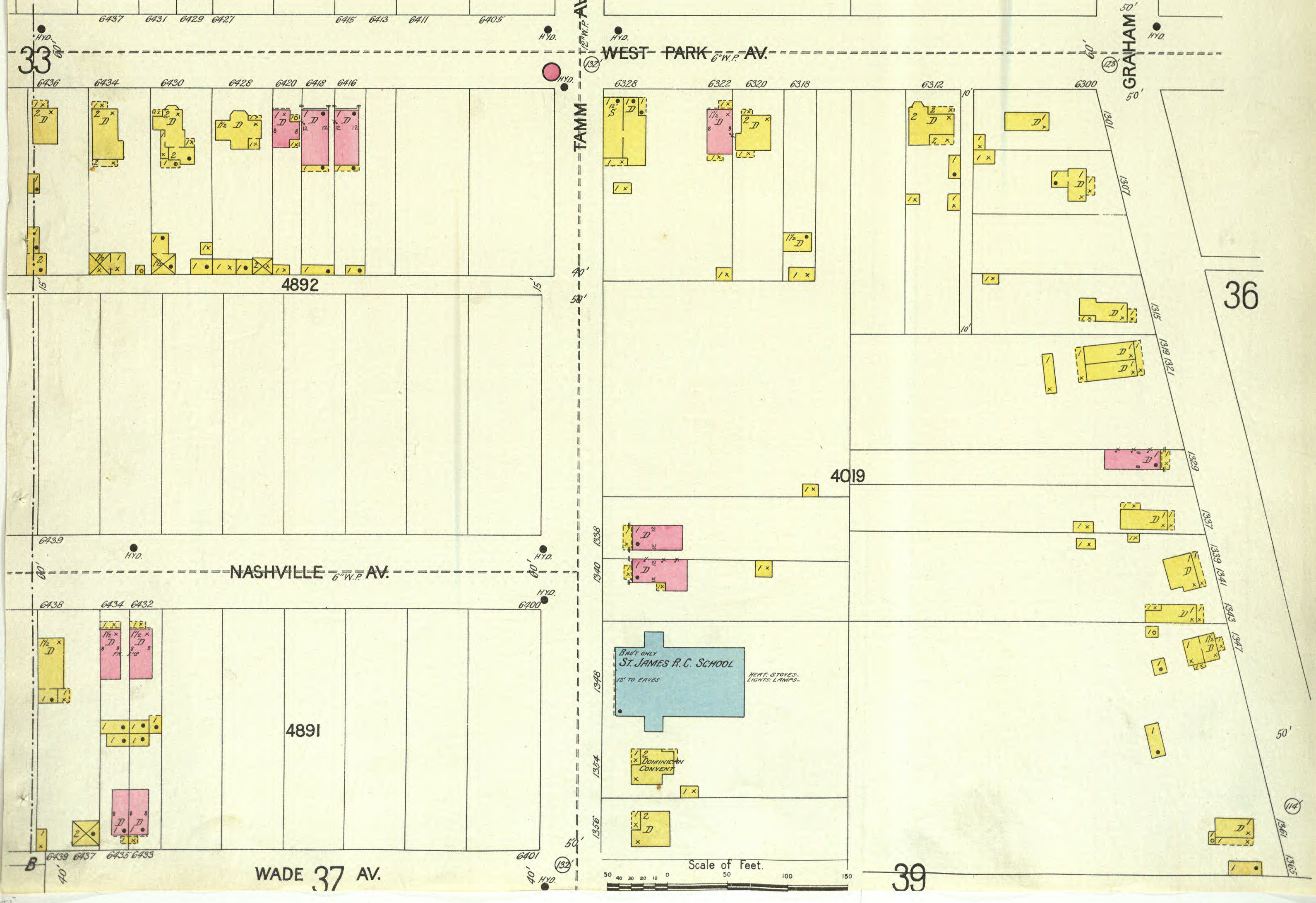
Also, you will note the maps are do have colors on them an below is the key to what those colors mean:
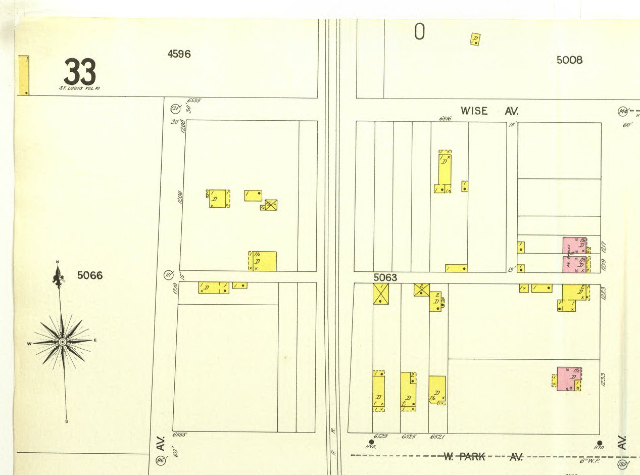
I will begin below with map 33, which I have cut into four pieces (33a,33b, 33c, 33d) so that you can see more detail.
Note: The original digital copies of all the maps may be viewed and enlarged at http://digital.library.umsystem.edu/
(BELOW) Map 33a runs from:
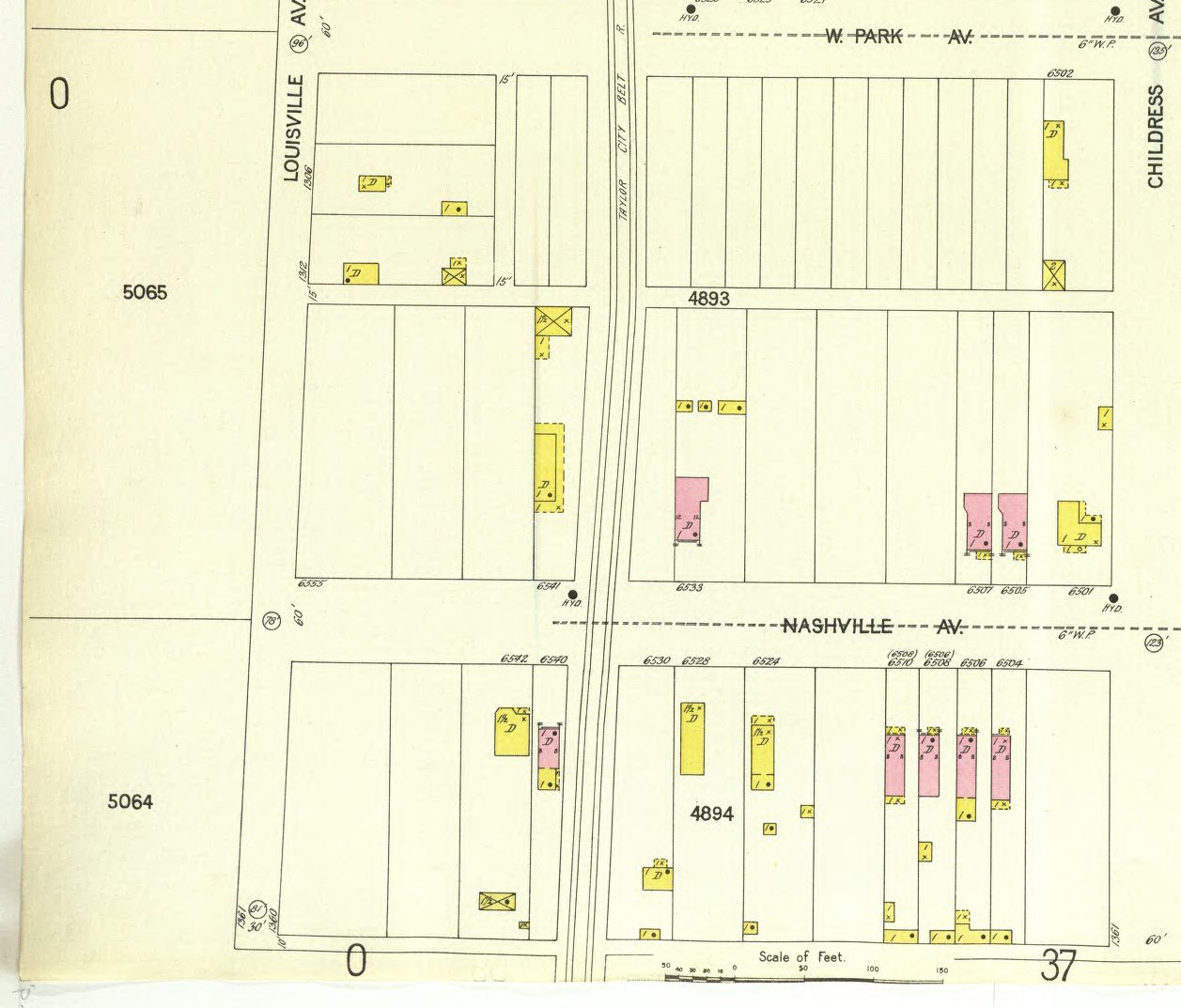
(ABOVE) Map 33b is the continuation of Sanborn map 33A above. Part B runs from:
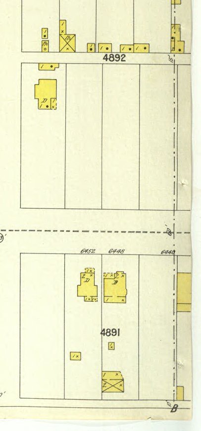
These map pieces above are the eastern part of map 33, maps 33c and 33d.
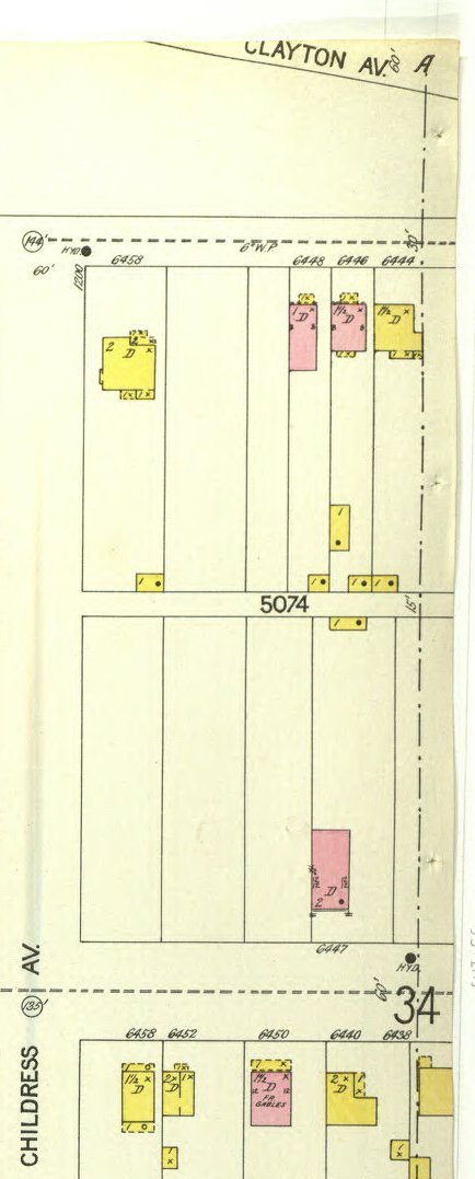
This map is begins at Childress and Wade, which is just next to the number 33.
Just to the left of this map (and there is no map for that section) is where the Taylor City Belt Line is running north to south, about 2/3 the way down "big" Wade.
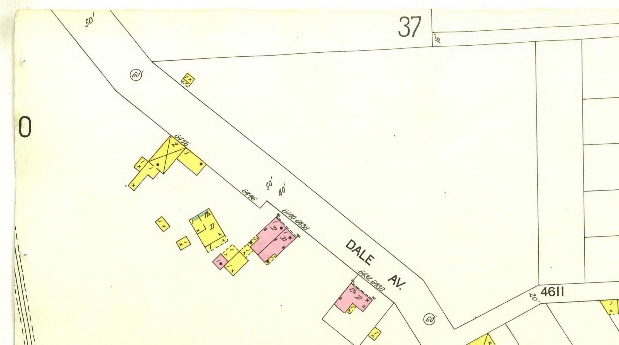
The bottom of the map is at the corner of Manchester and Dale, where Dale slants off toward the northwest. It is the same today. Just where the upper (northwest) part of Dale is, just to the west runs the Taylor City Belt Line toward Louisville and alongside the left side of this map to where it joins map 33 at Wade Ave.
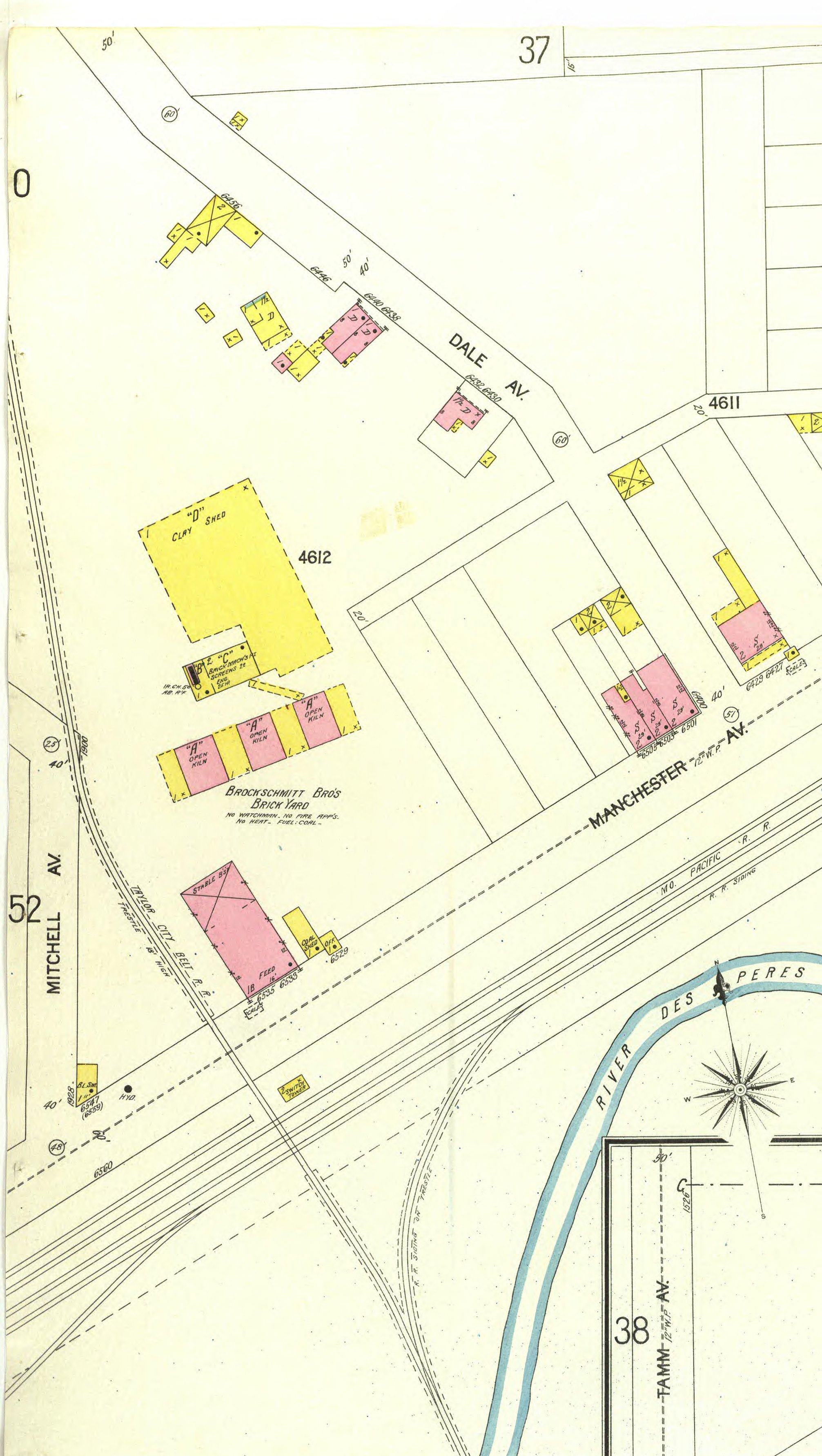
This map is very revealing for the route of the Taylor City Belt Line. The trains (both Pacific and Frisco) came from the EAST on the Frisco tracks, and then went south until they were far enough south to go north up onto the tressle which went over the River des Peres, and was high enough (18 feet high says the map) that the train could then handle the grade all the way up to Clayton Ave.
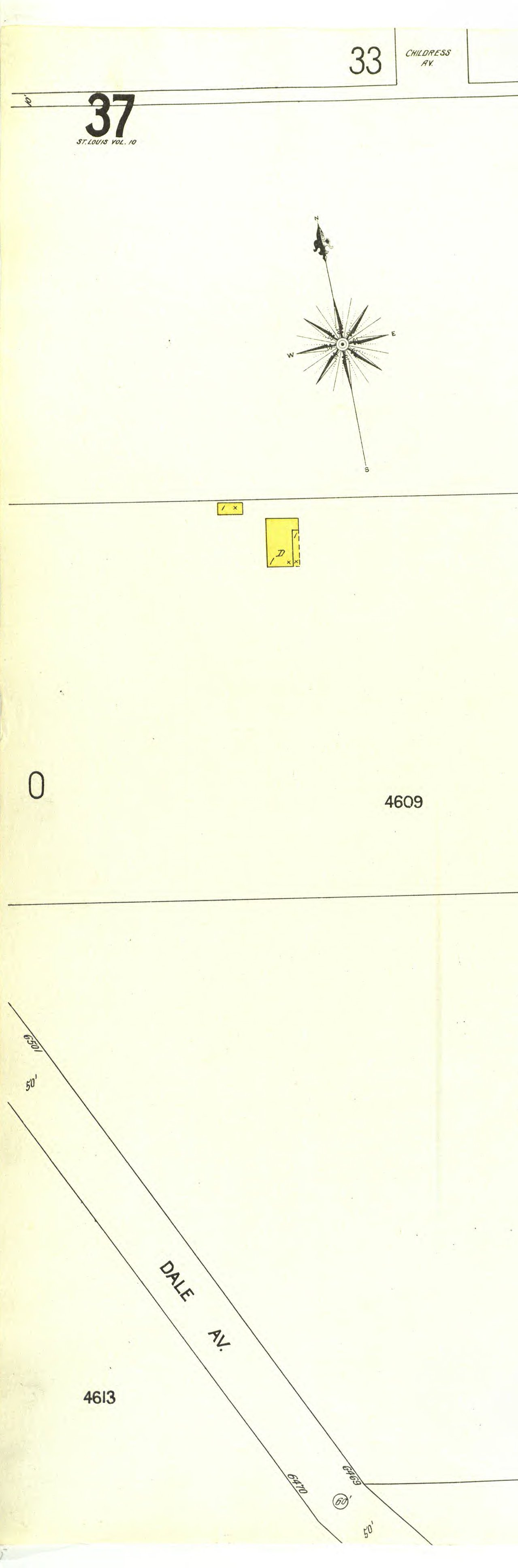
The top of map 38a is Lloyd and Dale. Note that today Dale continues on west which would be the extension of Lloyd were it so named. Then "Dale" continues north on what is today Sanford.
The bottom of the Map is along Manchester and one can follow the Taylor City Belt Line as it goes up alongside the EAST side of Mitchell until where Mitchell turns north at Sanford.
Note that on map 382a the Taylor City Belt Line is to the left, near Mitchell.
There are a few houses along Dale, just northwest of Manchester.
Where the number 4611 shows is the alley way (still there) that runs from Tamm to Dale, just behind today's Cooper Tire Co.
Dogtown from:
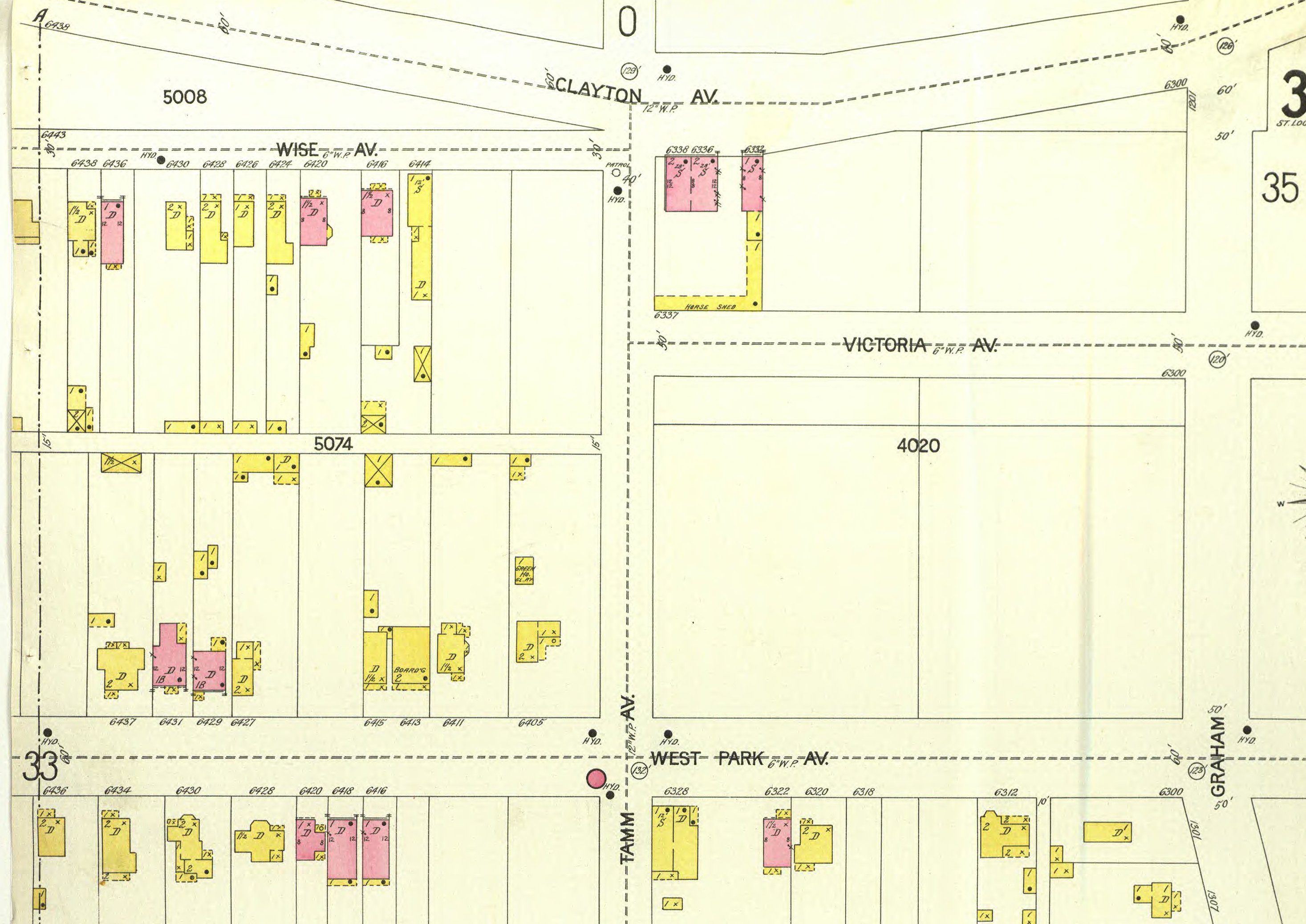
Note that this map does not begin at Childress and Wise on the west, but about 4 or 5 house east on Wise Ave. The other part of the 6400 block of Wise is on may 38a.
Note that at Tamm and Clayton there is one building. However, before the Fair opened just 16 months later, there was a tavern on Tamm (now the builing of the Dogtown Frame Shop), which had a large beer sign on the wall advertising Alpen Brau beer which was making its debut at the World's Fair.
Another set of buildings which aren't on this map are the 6 "temp" houses on the north side of Nashville, just west of Tamm. Those would be build within the year since they were "temporary houses" for World's Fair workers. They are all still standing. Some "temporary!"
Map 37 will shop that there were quite a few houses on the SOUTH side of the 6400 block of Wade (west of Tamm). That is not shown on this map.


Some notes on this map:

Some notes on this map:

| HOME | DOGTOWN |
| Bibliography | Oral history | Recorded history | Photos |
| YOUR page | External links | Walking Tour |